WATSON, John.
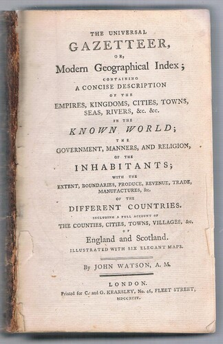
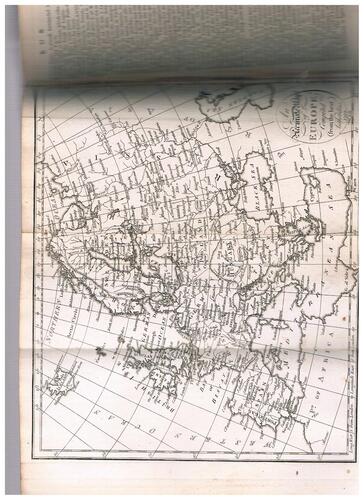
| Title | The Universal Gazetteer, or, Modern Geographical Index: containing a concise description of the empires, kingdoms, cities, towns, seas, rivers, &c., &c. in the known world; the government, manners, and religion, of the inhabitants; with the extent, boundaries, produce, revuenue, trade manufactures, &c. of the Different Countries. Including a full account of the Counties, Cities, Towns, Villages, &c. of England and Scotland. Illustrated with six elegant maps. |
|---|---|
| Publisher | London Printed for C. and G. Kearsley, No. 46, Fleet Street, MDCCXCIV. |
| Date | 1794 |
| Book ID | 38742 |
| First Edition |
Description
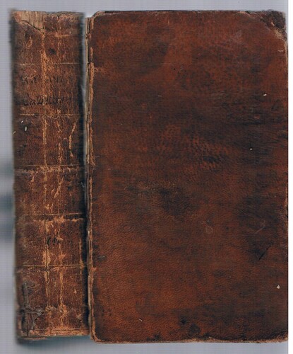
8vo.. Full contemporary leather, spine ruled gilt with title in ink. x pp.+unpaginated in two columns. Six maps (complete as called for) engraved for this particular work, tables.
In good condition but upper board detached although present. Spine rubbed and cracked a little, chipped at ends. Board corners bumped.
Gazetteers, or geographical dictionaries, have been produced since the Hellenistic Age in Europe and in Ancient China. In Britain, they began to gain popularity in the eighteenth century, and by the nineteenth century were widely published. This gazetteer by John Watson is similar in arrangement and content to others in the latter half of the C.18th, and is particularly enhanced by its engraved folding maps. “Wiveliscombe was famous for its brewery built in 1807 by William Hancock. The Hancock family exercised a huge influence on the town for many decades.” (Wiveliscombe Town Council, 2021).
Only two in COPAC. Rare.
William Hancock of Wiveliscombe’s copy, dated 1793 and 1797 with his stamp and pasted label to paste-down. Later ownership label to f.e.p.. "Ex libris T.G. Alderman. Consacrons nous à ce saint oeuvre"
Price:
£200.00
Other books in this category
£80.00
£30.00